Contact
admin
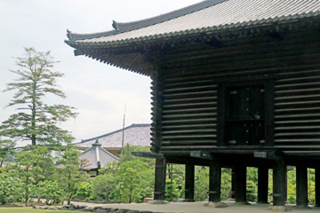
![]()
Electronic Footprints:
Walking the Yamanobe-no-michi (Nara Japan)
Japan's oldest trail, whose name appears in the country's oldest book,
written 1,300 years ago.
Photo Gallery: Tracing history back from the Nara period to the Fujiwara-kyo
and Asuka periods.
Prologue
This page describes a walk along the Yamanobe-no-michi, Japan's oldest
trail, which winds through the mountain villages east of the Nara Basin.
The name of the Yamanobe-no-michi is mentioned in the Kojiki, written in 712 AD, and the Nihon Shoki, written in 720 AD. Because of its mention in these texts, the Yamanobe-no-michi is considered Japan's oldest road.
The starting point is Kanaya, present-day Sakurai City, Nara Prefecture, the site of the introduction of Buddhism to Japan, and the oldest trading market, Tsubaichi, which had ties to the continent via the Yamato River's water transport system and was the location of the Asuka-Fujiwara Palace, a site expected to be registered as a World Heritage Site. The finish point is the Great Buddha of Nara (Vairocana Buddha) at Todai-ji Temple in Nara City, where Buddhist culture flourished.
This is a 1300-year time travel journey that traverses time and space, from ancient times to the present day. Here you'll find the Fujiwara Palace ruins, the site that laid the foundation for the future of Japan, numerous burial mounds, shrines and temples scattered throughout the foothills, and finally, the solemn yet vibrant atmosphere of the Great Buddha (Rushana Buddha) of Nara at Kasuga Taisha Shrine and Todai-ji Temple, bustling with tourists.
The following is an account from the "Kojiki". An excerpt from the chapter concerning Emperor Sujin.
≪Original text≫ 御陵在山邊道勾之崗上也
≪Decoded Japanese text≫ 御陵は山辺の道の勾の岡の上に在り
≪English≫ The imperial tomb is located on the hill of Magari on the Yamanobe-no-Michi road.
This is an excerpt from the original text of the chapter on Emperor Keikō in the Kojiki.
≪Original text≫ 御陵在山邊道上
≪Decoded Japanese textt≫ 御陵は山辺道の上ほとりに在り。
≪English≫ The imperial tomb is located along the Yamanobe-no-Michi road.
A waka poem from the Manyoshu, an anthology compiled between the late 7th and late 8th centuries.
《Original text》春日野之 山邊道乎 与曽理無 通之君我 不所見許呂香聞
《Decoded Japanese text》春日野の 山辺の道を 恐なく 通ひし君が 見えぬころか
《English》Along Yamanobe-no-Michi, through Kasugano,
you once came to me without fear.
Have the days now come when I no longer see you?
Many "waka" poems associated with the Yamanobe-no-Michi trail are included, starting with these.
Yamanobe-no-michi Route Map
| Prefecture | Section Walked | Date of walk | GPS Distance walked |
|
| Nara |
Sakurai Station – Tenri Station | May 12, 2026 | 16.0km | |
| Nara |
Tenri Station to Todai-ji Temple | May 13, 2026 | 18.8km | |
| 合計 | 34.8km |
 |
 |
|
| ↑A map with GPS logs and photos mapped onto it will open. | How to view the GPS log as a tour in Google Earth (Japanese) |
カシミール3D フリーソフト轍 国土地理院
The Palace Capitals of Asuka and Fujiwara 飛鳥・藤原の宮都
The starting point of the Yamanobe-no-michi Trail is the area where Asuka-kyo and Fujiwara-kyo—the capitals where the ancient Japanese state was established—once stood.The History of the Asuka and Fujiwara Capitals.
Located in the southern part of the Nara Basin, the history of the Asuka and Fujiwara capitals began in 592 AD—during the Asuka period (late 6th to late 7th centuries)—when Empress Suiko established her palace in the Asuka region. At that time, the capital would shift locations within the Asuka area whenever a new emperor ascended the throne.
In 645 AD, the "Isshi Incident"—in which Prince Naka-no-Oe (later Emperor Tenchi) and Nakatomi no Kamatari assassinated Soga no Iruka at the Asuka Itabuki Palace—triggered the "Taika Reforms," leading to a shift toward a political system centered on the Emperor.
The Jinshin War of 672 AD: Following the death of Emperor Tenchi (reigned 668–671), a succession dispute arose between his younger brother, Prince Oama, and his son, Prince Otomo; Prince Oama emerged victorious.
In 673 AD, Prince Ōama, having emerged victorious, ascended the throne as Emperor Tenmu (reigning from 673 to 686 AD); he established a powerful, centralized state centered on the Emperor and instituted the titles "Tennō" (Emperor) and "Nihon" (Japan) for the sovereign and the nation, respectively.
686 AD: Emperor Tenmu passed away. His son, Prince Kusakabe, conducted affairs of state as Crown Prince, while the late Emperor's consort, Princess Uno no Sarara, also participated in governance by assisting him.
689 AD: Prince Kusakabe died at the age of 28.
690 AD: Emperor Tenmu’s consort, Princess Uno no Sarara, ascended the throne as Empress Jitō. She took over the construction of Fujiwara-kyō—a project initiated by Emperor Tenmu—and drove the construction process forward.
694 AD: The capital of Fujiwara-kyo was established. It subsequently served as the imperial seat for three successive reigns: those of Empresses Jito and Genmei, and Emperor Monmu.
710 AD: Empress Genmei relocated the capital to Heijō-kyō, and Fujiwara-kyō ceased to be the capital.
Dimensions of Fujiwara-kyō
East-West: approx. 5.3 km; North-South: approx. 4.8–5.3 km; Total area: approx. 25 sq. km.
It is estimated that between 20,000 and 50,000 people lived there.

Note: Annotations were added by the author to an aerial photograph provided by the Geospatial Information Authority of Japan (GSI).

Note: The author has added annotations to a photograph of a diorama displayed
at the Fujiwara-kyo Information Center in Kashihara City.
A view looking north from the Daigokuden (Great Hall of State) site toward the Dairi (Inner Palace) area.
The Three Mountains of Yamato.
香具山 Mount Kagu
Man'yōshū, Book 1, Poem 28 — Empress Jitō
《Original text》春過而 夏来良之 白妙能 衣乾有 天之香来山
《Decoded Japanese text》
春過ぎて 夏来るらし 白妙の 衣ほしたり 天の香具山
≪English≫Spring has gone;summer has arrived.Upon Mount Amanokagu,pure white robesare hanging out to dry.
I imagine that Empress Jitō composed this poem based on the scenery of Mount Kagu as viewed from the Imperial Palace complex at Fujiwara-kyū around the month of June.
Mount Unebi Mount Miminashi
Prince Naka-no-Ōe (Emperor Tenji) Man'yōshū*, Book 1, Poem 13
《Original text》 《Decoded Japanese text》
高山波 雲根火雄遠等 香具山は 畝傍ををしと
耳梨與 相諍競 耳成と 相あらそひき
神代従 如此有良之 神代より かくにあるらし
古昔母 然有許曾 古も 然にあれこそ
虚蝉毛 嬬乎 諍良之吉 うつせみも 妻をあらそふらしき
《English Translation》
Mount Kagu, longing for fair Unebi,
strove against Mount Miminashi.
Such, it seems, has been the way
since the age of the gods.
So it was in ages past,
and so it is today:
even we who live but briefly
rival one another for a bride.
Starting Point:
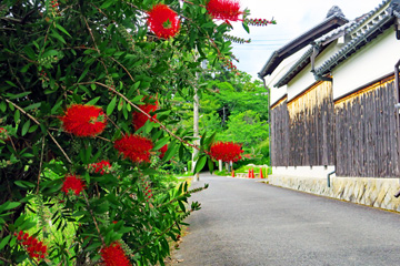
Sakurai City – The Site of the Introduction of Buddhism to Japan
Umaide Bridge 馬出橋
The journey begins by crossing Umaide Bridge, which spans the Yamato River.
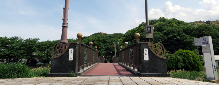
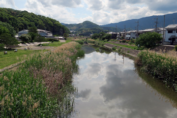
Yamato River 大和川

Monument marking the site of the introduction of Buddhism 仏教伝来地の碑
It stands at the northern end of Umaide Bridge.
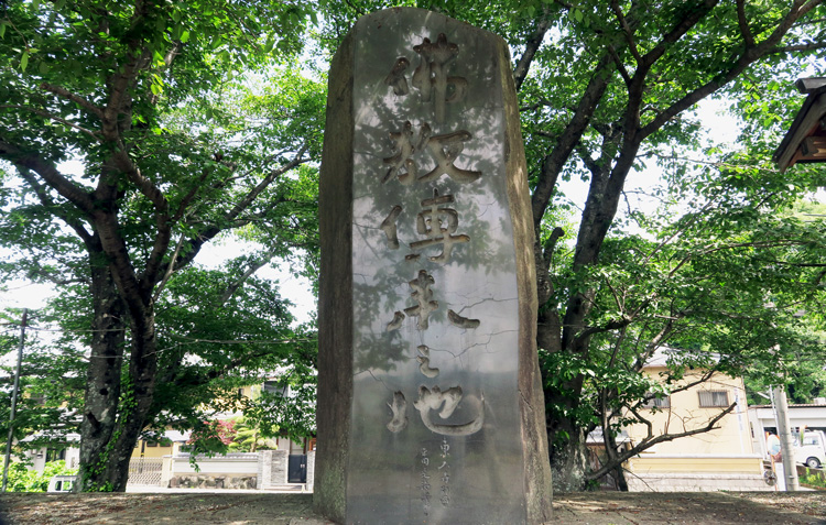
Why is this place said to be the site where Buddhism was introduced?
To summarize the information on the explanatory board: This riverside area was a central hub of the ancient Yamato Court, home to sites such as the Shiki no Mizukaki-no-miya and Shikishima no Kanasashi-no-miya palaces, as well as Tsubaichi—one of the earliest trading markets. Furthermore, a river port serving the capital was located nearby; it was the terminus for waterborne transport via the Yamato River from present-day Osaka Bay (Naniwa-tsu) and served as the arrival and departure point for envoys from foreign nations maintaining diplomatic ties with the Yamato Court.
The "Nihon Shoki" (Chronicles of Japan) contains the following account:
《Original text》冬十月 百濟聖明王 遣西部姬氏達率怒唎斯致契等 獻釋迦佛金銅像一軀・幡蓋若干・經論若干卷
《English Translation》
In the winter of the thirteenth year of Emperor Kinmei's reign (October 538 CE), King Seong of Baekje dispatched as envoys Nulisichigye, who held the rank of Dalsol and belonged to the Kishi clan of the Western District, together with others. They presented to the Japanese court a gilt bronze statue of Śākyamuni Buddha, Buddhist banners and canopies (hangai) used to adorn the Buddha, as well as several volumes of Buddhist sutras and treatises.
In short, this indicates that Buddhist statues and scriptures were transmitted via a route spanning the Korean Peninsula, the Tsushima Strait, the Seto Inland Sea, Osaka Bay, and finally the Yamato River. It is truly remarkable that such a long journey was undertaken some 1,500 years ago—an era when neither shipbuilding nor navigation techniques were particularly advanced.
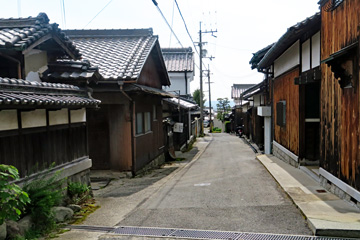
Kanaya District 金屋地区
This settlement lies a few hundred meters across the Yamato River. In ancient times, this was the site of the "Tsubaichi" trading market; it likely bustled with activity comparable to modern-day Ginza in Japan, the Champs-Élysées in France, or Times Square in New York.

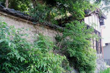
Kanaya Stone Buddha 金屋の石仏
Man'yōshū, Volume 13
《Original Text》式嶋乃 山跡乃土丹 人二 有年念者 難可将嗟
《Decoded Japanese text》
磯城島の大和の国に人ふたりありとし思はば何か嘆かむ
《English Translation》
Were there truly two whom I loved in this land of Yamato, fair Shikishima, I would indeed have reason to lament. Yet there is only one whom I hold dear: you, and you alone.
Note: "Shikishima" is the place name for the area around present-day Kanaya.
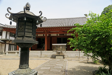
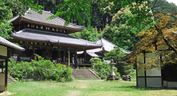
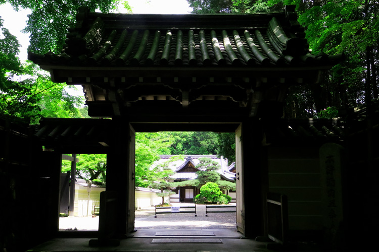
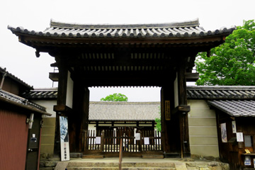
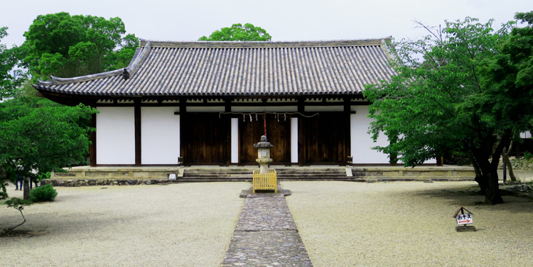
Miwayama Byōdō-ji Temple 三輪山平等寺
This temple is said to have been founded by Prince Shotoku in 581 AD. Its vermilion "Red Gate," main hall, and two-story Shakado Hall create a beautiful scene as they stand out against the surrounding green trees.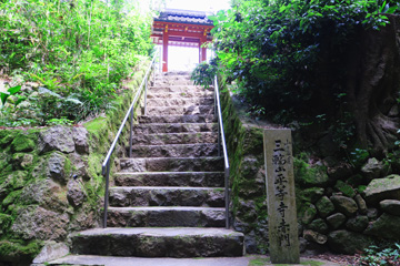

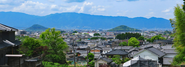
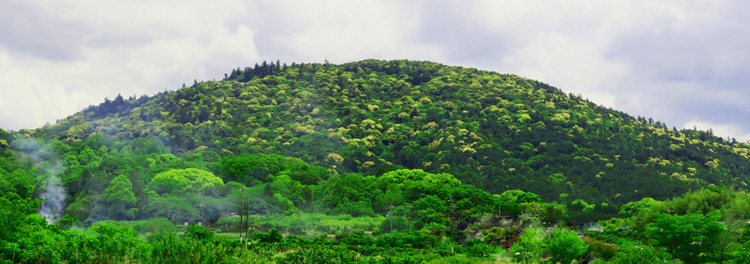
Mount Unebi and Mount Miminashi (Two of the Three Mountains of Yamato)
A view of the Nara Basin seen while traveling from Mt. Miwa Byodo-ji Temple to Omiwa Shrine.
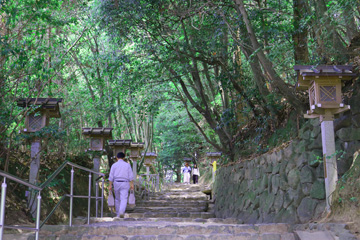
Omiwa Shrine 大神神社
One of Japan's oldest shrines, it enshrines Mount Miwa itself as a sacred object of worship.It has no main sanctuary building; instead, it preserves an ancient form of nature worship in which devotees pray to Mount Miwa from the *haiden* (hall of worship).
In the Age of the Gods, the deity Omononushi-no-Okami requested, "Enshrine me upon the mountain to the east of Yamato (Mount Miwa)," and subsequently took up residence there.
During the reign of Emperor Sujin, the worship of Mount Miwa fell into decline, and a plague—possibly a divine curse—spread across the land. Emperor Sujin received a divine oracle in a dream stating, "If you have my descendant, Ootataneko, perform rites to honor me, the plague will subside." After Ootataneko was found and appointed as the chief priest of Mount Miwa to conduct the rituals with great reverence, the plague abated, and the tradition of worshipping Mount Miwa as a guardian deity of the nation was established.

Mt. Miwa 三輪山
Omiwa Shrine Hall of Worship (Haiden)
大神神社拝殿
Manyoshu, Volume 9–1684 Kakinomoto no Hitomaro
《Original Text》春山者 散過去鞆 三和山者 未含 君持勝尓
《Decoded Japanese text》
春山は 散り過ぎぬとも 三輪山は
いまだふふめり 君待ちかてに
《English Translation》
The blossoms may have already fallen on the mountains of spring, But on Mount Miwa, the buds remain—waiting impatiently for you.

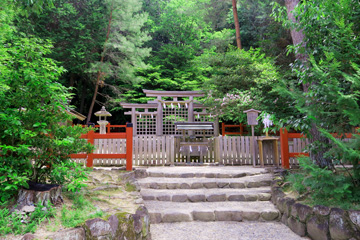
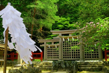
Hinohara Shrine (Auxiliary Shrine of Omiwa Shrine)
Mausoleums of Emperor Sujin and Emperor Keiko
About Emperor SujinHe was the 10th Emperor and is considered the first whose historical existence can be confirmed; he is estimated to have reigned from the early to mid-3rd century. The *Kojiki* describes him as the first emperor to pacify the land, advance irrigation projects, and enable the people to live in peace.
≪Original text≫ 御陵在山邊道勾之崗上也
≪Decoded Japanese text≫ 御陵は山辺の道の勾の岡の上に在り
≪English≫ The imperial tomb is located on the hill of Magari on the Yamanobe-no-Michi road.
About Emperor Keiko
He was the 12th Emperor, reigning from the late 3rd century to the early 4th century. He was the father of Yamato Takeru no Mikoto and is said to have personally traveled to Kyushu to suppress the rebellion of the Kumaso people.
This is an excerpt from the original text of the chapter on Emperor Keikō in the Kojiki.
≪Original text≫ 御陵在山邊道上
≪Decoded Japanese textt≫ 御陵は山辺道の上ほとりに在り。
≪English≫ The imperial tomb is located along the Yamanobe-no-Michi road.
The *Kojiki* mentions the Yamanobe-no-Michi (Yamanobe Road) in these two passages, noting that the mausoleums of both Emperor Sujin and Emperor Keiko are located alongside this road.
The pink line in the photo below indicates the route of the Yamanobe-no-Michi. As described in the *Kojiki*, there are two large *kofun* (ancient burial mounds) situated along the Yamanobe-no-Michi.

© Google Earth
Mausoleum of Emperor Keiko 景行天皇陵Keyhole-shaped burial mound;
total length: approx. 300 m; height: approx. 25 m
It was so massive that I couldn't fit it all into a single photograph.

Mausoleum of Emperor Sujin 崇神天皇陵
Keyhole-shaped burial mound;
Total length of mound: approx. 242 m; total length including the surrounding moat: 360 m; height of the circular rear section: approx. 31 m
This footage shows only the circular rear section of the burial mound.
The Three Mountains of Yamato: Mt. Kagu, Mt. Unebi, and Mt. Miminashi
The Nara Basin as seen from high ground near the Mausoleum of Emperor Keiko.
Prince Naka-no-Ōe (Emperor Tenji) Man'yōshū*, Book 1, Poem 13
《Original text》 《Decoded Japanese text》
高山波 雲根火雄遠等 香具山は 畝傍ををしと
耳梨與 相諍競 耳成と 相あらそひき
神代従 如此有良之 神代より かくにあるらし
古昔母 然有許曾 古も 然にあれこそ
虚蝉毛 嬬乎 諍良之吉 うつせみも 妻をあらそふらしき
《English Translation》
Mount Kagu, longing for fair Unebi,
strove against Mount Miminashi.
Such, it seems, has been the way
since the age of the gods.
So it was in ages past,
and so it is today:
even we who live but briefly
rival one another for a bride.
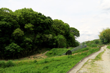
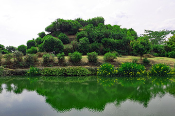
Yamato Kofun (ancient burial mound)Group
Numerous burial mounds, collectively known as the Yamato Kofun Group, are scattered across the area north of the Mausoleum of Emperor Sujin. Please look at the photograph below. North is to the right, and the blue line indicates the Yamanobe-no-Michi (Yamanobe Road). You can see that there are many burial mounds situated along this road. This area offers insight into the evolution of burial mound construction, as it features a mix of styles—such as keyhole-shaped mounds (*zenpō-kōenfun*) and those with square front and rear sections (*zenpō-kōhōfun*)—and has yielded a diverse array of grave goods.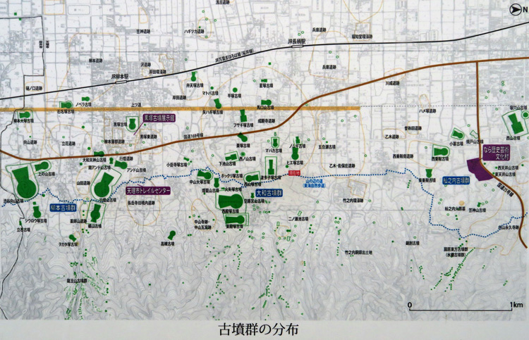
Reprinted from the information board.

©GoogleEarth
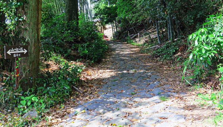
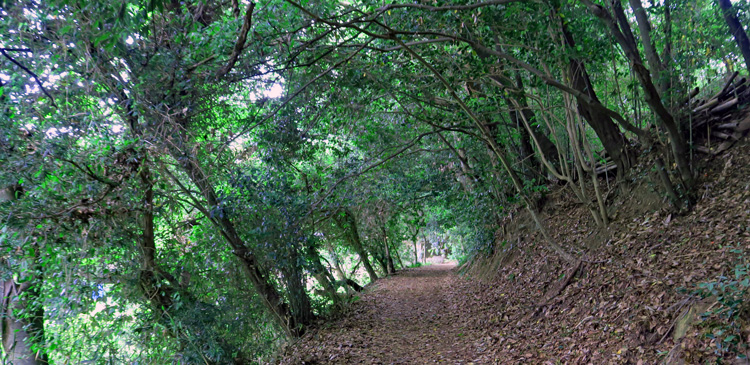
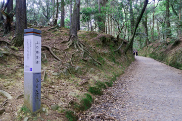
Scenery along the route:
Nakayama-cho → Kayō-cho → Takenouchi-cho → Sonohara-cho
Views of the Yamanobe-no-Michi as it winds through the Yamato Kofun Group.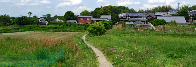
Manyoshu, Volume 19-4292, Otomo no Yakamochi
《Original text》 宇良宇良尓 照流春日尓 比婆理安我里 心悲母 独之念者
《Decoded Japanese text》
うらうらに 照れる春日に ひばりあがり 心悲しも 独りし思へば
《English Translation》
On this serene, sunlit spring day,
as the skylark soars into the sky,
my heart is filled with sadness—
for I am left alone with my thoughts.
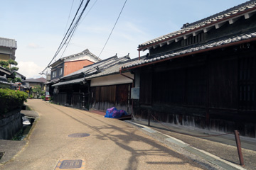
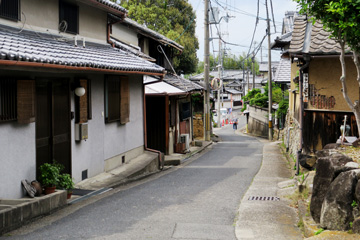
Photo (left): Rows of houses in Nakayama-cho
Photo (right): The slope leading to Nakayama Kannon-ji Temple
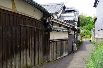
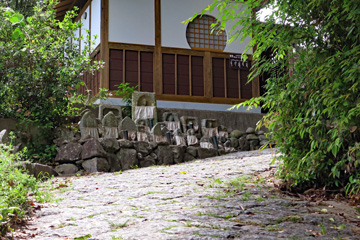
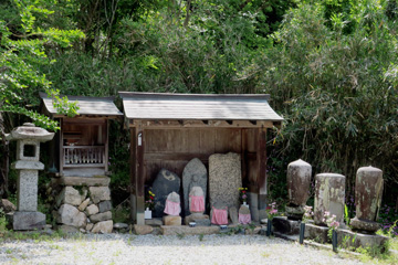
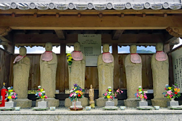
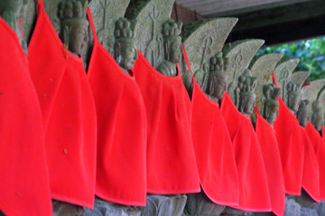
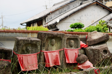
Photo (Left): Nishiyamazuka Kofun
Photo (Right): Six Jizo Statues
Jizō is a Buddhist guardian figure in Japan who is believed to protect children, travelers, and the spirits of the deceased.
Near Takenouchi-cho 竹之内町付近
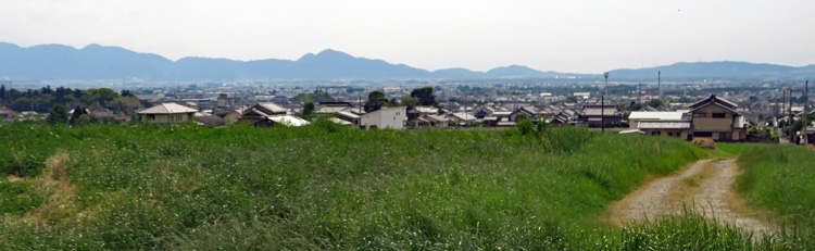
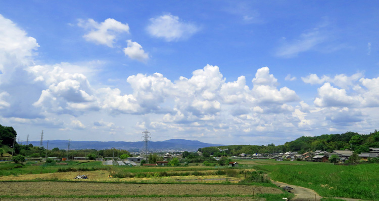
This is a view of the northwestern part of the Nara Basin.
Near Otogi-cho 乙木町付近
The Stone Pavement of Sonohara 園原の石畳
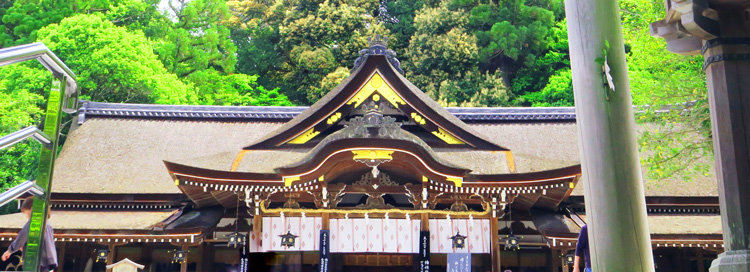
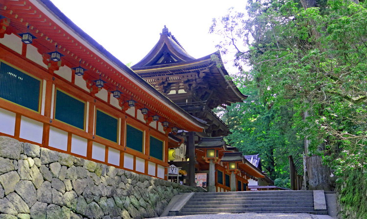
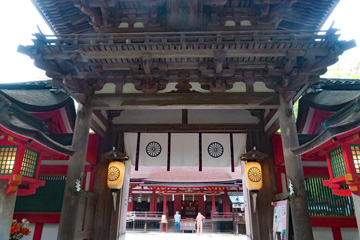
Isonokami Shrine 石上神宮
Today's final destination.This shrine is considered the principal tutelary shrine of the Mononobe clan, a powerful family during the Asuka period.
The principal deity enshrined here is Futsunomitama-no-Ōkami; this deity is regarded as the divine spirit residing within "Futsunomitama," a sacred sword that appears in Japanese mythology.
The sacred objects enshrined here include:
"Futsunomitama," the divine sword that played a pivotal role in Emperor Jimmu's pacification of the land; the "Amatsu-shirushi-tokusa-no-mizu-no-takara" (Ten Sacred Treasures), divine artifacts associated with rituals for calming and revitalizing the spirit; and "Ame-no-totsuka-no-tsurugi," the divine sword used by the deity Susanoo-no-Mikoto to slay the eight-headed serpent, Yamata-no-Orochi.
The shrine also houses the "Shichishitō" (Seven-Branched Sword), a National Treasure said to have been presented as a gift from the ancient kingdom of Baekje.
Note:Baekje was a kingdom that reached its peak between the 4th and 5th centuries and ruled the southwestern region of the Korean Peninsula.

Man'yōshū, Book 10, Poem 1927 (Author Unknown)
《Original Text》石上 振乃神杉 神備西 吾八更々 戀尓相尓家留
《Decoded Japanese text》
石上(いそのかみ) 布留(ふる)の神杉(かむすぎ)
神(かむ)びにし 我(あ)れやさらさら恋にあひにける
《English Translation》
At Furu in Isonokami stands the sacred cedar, old with holiness.
So old have I become— yet here I am, unexpectedly in love.
After visiting Isonokami Jingu Shrine, I’ll head to JR Tenri Station and wrap up today’s walk.
From Tenri City to Todai-ji Temple in Nara
The next day, I started from JR Tenri Station on the Sakurai Line.This area is the center of Tenrikyo; I walked past rows of large religious facilities as I headed toward Isonokami Jingu Shrine—the endpoint of yesterday's walk.
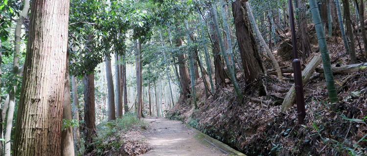
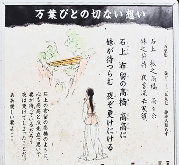
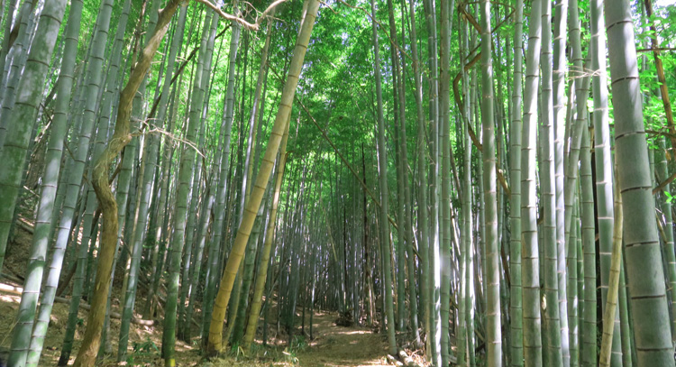
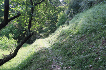 Shortly after passing Isonokami Jingu Shrine, the route turns into a narrow mountain path.
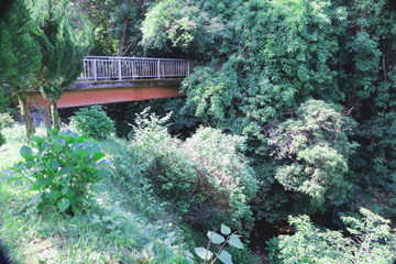
A celebrated poetic site: Furu no Takahashi (The High Bridge of Furu)
Not far from Isonokami Jingu Shrine, a small bridge spans the spot where the Haru Falls cascade into a deep ravine; this is the "High Bridge of Furu" (*Furu no Takahashi*), a site celebrated in classical poetry.Man'yoshu, Book 12, Poem 2997 (Author Unknown)
《Original Text》石上振之高橋高高尒妹之将待夜曽深去家留
《Decoded Japanese text》
石上 布留の高橋 高高に 妹が待つらむ 夜ぞ更けにける
《English Translation》
At lofty Takahashi Bridge in Furu of Isonokami,
my beloved must be gazing into the distance, waiting for me,
as the night deepens.
Kokuzō-san Kōnin-ji Temple 虚空蔵山弘仁寺
This is a temple of the Kōya-san Shingon sect, standing in solitary isolation deep within the mountains, far removed from human settlements.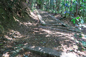
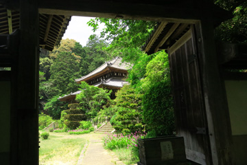
While majestic temples located in popular tourist areas certainly have their appeal, there is a soothing quality to temple buildings that stand quietly amidst the mountains. I took a nap in a shady corner of the grounds; not only did I regain a bit of physical energy, but more importantly, I felt a deep sense of inner calm.
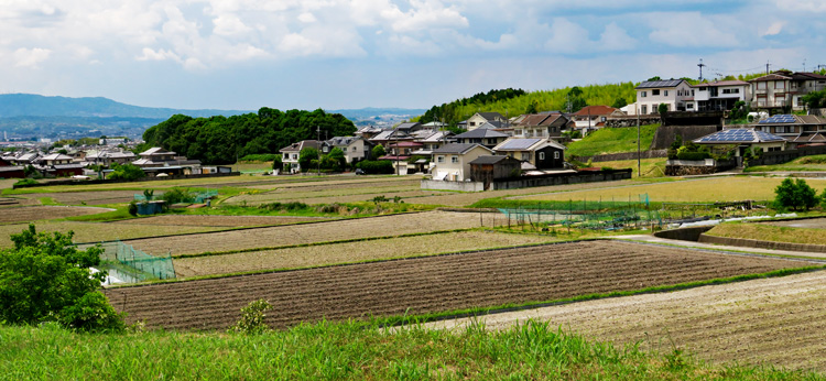
The view of Takahi-cho from the path down from Konin-ji Temple.
Fumon-san Enshō-ji Temple 普門山円照寺
A nunnery belonging to the Myōshin-ji branch of the Rinzai sect. Although I did not enter the temple grounds, the temple exuded a serene and elegant atmosphere.

This scene lies just four kilometers as the crow flies from the center of Nara City—an area usually bustling with school trip groups and international tourists. Here, however, a peaceful rural landscape stretches out before you.
Byakugo-ji-cho 白毫寺町
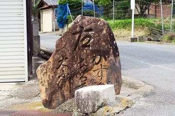 A stone signpost located at a three-way intersection just before the approach to Byakugo-ji Temple. It bears the inscription: "Right: Kasuga, Shortcut, Great Buddha"
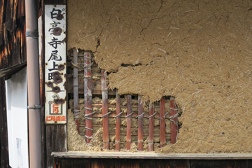
Shin-Yakushi-ji Temple 新薬師寺

Within the precincts of Kasuga Taisha Shrine
春日大社境内
Man'yoshu, Book 3, Poem 328 – Ono no Oyu
《Original Text》青丹吉 寧楽乃京師者 咲花乃 薫如 今盛有
《Decoded Japanese text》
あをによし 奈良の都は 咲く花の
にほふがごとく 今盛りなり
《Decoded Japanese text》
The capital of Nara, beautiful with blue and ocher
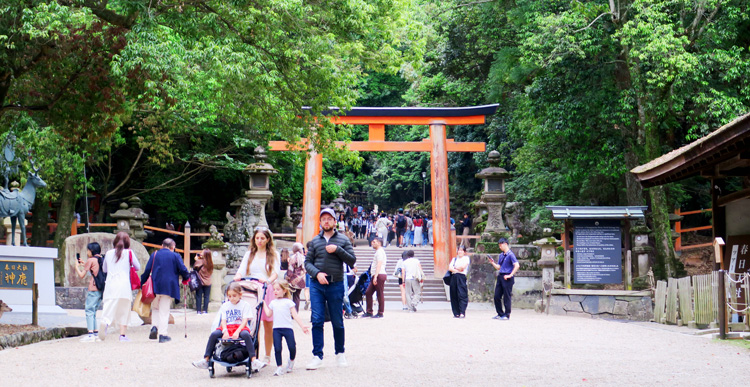
After walking about 200 meters past Shin-Yakushi-ji and reaching a T-junction, I suddenly found myself surrounded by crowds of tourists. Seeing so many visitors, I realized I had arrived at Kasuga Taisha Shrine.
Kasuga Taisha Shrine – Nino-Torii (Second Torii Gate) 春日大社 二之鳥居
Mount Wakakusa 若草山
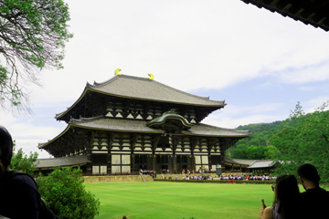
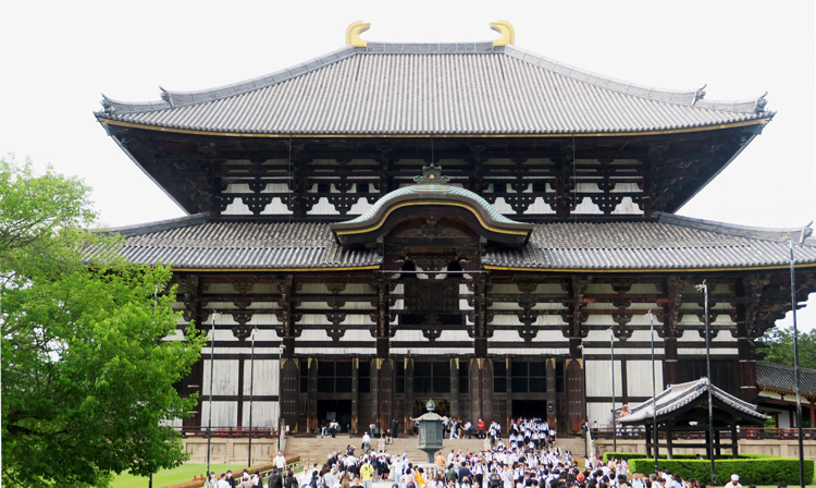
Todai-ji Temple: Head Temple of the Kegon Sect
華厳宗大本山 東大寺
Founded in the Nara PeriodIn the 15th year of the Tenpyō era (743 AD), Emperor Shōmu issued an imperial decree for the construction of the Great Buddha. The body of the Great Buddha was cast in the 21st year of Tenpyō (749 AD), coinciding with the construction of the Great Buddha Hall. A magnificent eye-opening ceremony was held in the 4th year of Tenpyō-Shōhō (752 AD).。
Damage and Reconstruction in the Kamakura and Edo Periods
Subsequently, the Great Buddha sustained damage, including the loss of its head during a massive earthquake in 855. In 1180, the majority of the temple complex was destroyed by fire during the military campaigns of Taira no Shigehira. Later, in 1567—during the Sengoku period—the Great Buddha Hall burned down due to fires caused by the forces of the Miyoshi and Matsunaga clans. Although the Great Buddha was housed in a temporary shelter, the structure collapsed in a strong wind, leaving the statue exposed to the elements for nearly a century. Despite the damage to the Great Buddha and the destruction of much of the temple complex caused by earthquakes and warfare, the structures were rebuilt during the Kamakura and Edo periods, eventually surviving into the Meiji era.
Repairs during the Meiji era
By the Meiji era, the Great Buddha Hall had deteriorated significantly, leading to its dismantling and repair in 1912 (the 45th year of the Meiji era).
Repairs in the Showa Era
As roof leaks began to appear in the main hall, major repairs were undertaken over a period of seven years starting in 1973; the ceremony marking the completion of the restoration was grandly celebrated in the autumn of 1980.
I recall the footage of the commemorative concert performed by singer Masashi Sada on that occasion.
The fact that this Great Buddha—created some 1,300 years ago—stands before the world today, having endured numerous hardships and survived thanks to the efforts of so many people, is nothing short of a miracle that transcends mere religious significance.
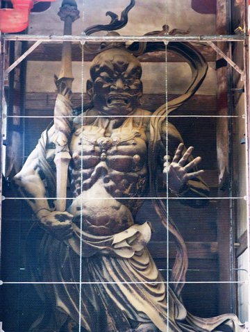
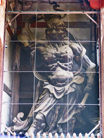
Statues of the Kongō-rikishi (Vajrapani) 金剛力士像
Photo (left): Statue of Agyō 阿形像
Photo (right): Statue of Ungyō 吽形像
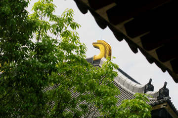
Great Buddha Hall 大仏殿
Gilt-bronze octagonal lantern 金銅八角灯篭
A gilt-bronze lantern dating back to the temple's founding in the Nara period. It was cast nearly 1,300 years ago.

Rushana-butsu (The Great Buddha of Nara)
廬舎那仏(奈良の大仏)
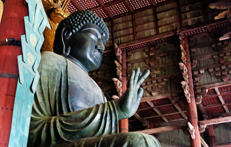
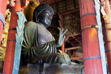
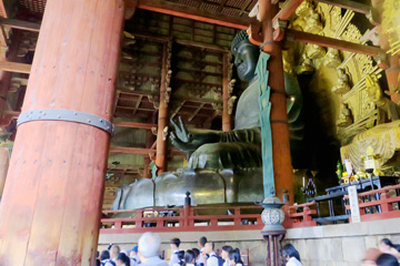
Size of the Great Buddha of Nara
Statue height: approx. 15 m; Pedestal height: approx. 3 m; Statue width: approx. 12 m; Weight: approx. 250 tons
Shōsō-in 正倉院
It stands approximately 300 meters north-northwest of the Great Buddha Hall. Its origins date back to 756 AD, when Empress Komyo dedicated the personal belongings of the late Emperor Shomu to the Rushana Buddha (the Great Buddha) and placed them in the *Shoso* (imperial repository) to pray for the repose of his soul. Other items associated with Todai-ji Temple were also housed there, bringing the total collection to around 9,000 pieces.
Note: The artifacts are currently stored in a separate, reinforced-concrete repository equipped with climate control.


The terminus of the Silk Road
Because it houses numerous treasures brought from the West, the Shosoin is often described as the "terminus of the Silk Road." From this point, routes extended westward across the sea to Korea, China, and Dunhuang, then crossed the Tian Shan Mountains and passed through Iran and Turkey to reach the Mediterranean.
Epilogue
I have visited Nara several times since my high school field trip. This
time, I walked the Yamanobe-no-Michi, said to be the oldest road in Japan.
I walked a path that has existed for over 1,300 years, read the poetry
monuments along the roadside, and—in order to write this page—read several
*waka* poems from the *Man'yoshu* anthology. While the poets ranged from
teenagers to the elderly, I felt that many of the poems—even those by older
individuals—possessed the youthful, fresh sensibility characteristic of
the transition from boyhood to young adulthood. The sensibilities of the
*Man'yo* people were such that even the elderly agonized and fell in love
just like young people, expressing their emotions and romances with frankness.
It made me wonder if the era in which they lived—whether the nation itself
or the people within it—was in a developmental stage akin to the fresh,
youthful vigor of adolescence.This English page is a translation of my original Japanese page, generated using Google Translate.
END
Created: June 23, 2026
 お買い物
お買い物Column
広告
広告